A group of passionate undergraduate students found a way to put a positive spin on Hurricane Helene while researching its impact on local waterways.
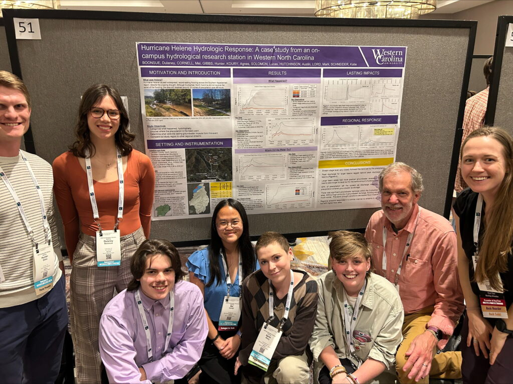
Through their research, the six students – Dulaney Boonsue, Mei Cornell, Hunter Gibbs, Agnes Koury, Lucus Solomon and Austin Hutchinson – discovered that significantly low groundwater prior to the storm helped reduce the potential impacts of Hurricane Helene.
“I think it’s important to note that before the storm we were in a 15 year low for our groundwater levels,” senior geology major Koury said. “So extreme drought conditions before Helene came in.”
The team stayed near WCU for research, collecting data from the Cullowhee Creek watershed and three nested watersheds: Wind, Gribble Gap and Long Branch.
In total, Cullowhee received 9.39 inches of rain during the hurricane. While this was much less than many neighboring areas, it is still much more than the region typically gets in the fall.
“Usually in September and October, we get about nine inches in total of rain, and we got those nine inches over a three-day period,” Sophomore environmental science and geology major Hutchinson said. “I think that helps put into perspective just how much rain there was.”
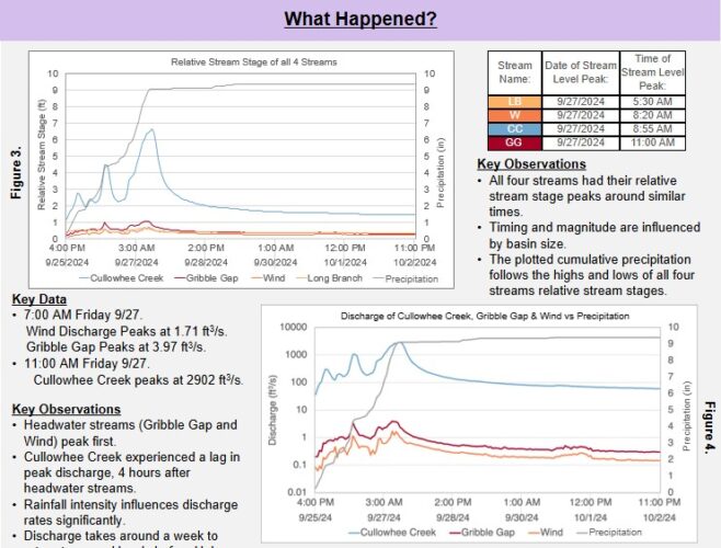
The team’s data shows that all four monitored streams peaked in discharge on the morning of Sept. 27. Normally, data from high-precipitation events will show a lag from the highest stream to the lowest stream in elevation, with the higher streams peaking earlier. In a mountainous terrain like Cullowhee, the team had expected to see this lag.
“Our peaks did not go in the same order that the streams are from highest to lowest in our watershed,” junior geology major Boonsue said. “Gribble Gap, one of the highest streams, peaked last instead of Cullowhee Creek which we expected to.”
Cullowhee Creek, the largest stream of the four, experienced the most discharge, peaking at around 2902 cubic feet per second.
The biggest question these researchers faced was figuring out where several inches of rainfall went after the storm, as only 40% of the accumulated water exited the watershed.
“We are looking for six inches of rain that went missing, essentially,” Boonsue said. “We think that it was indicative of an increase in our groundwater storage.”
To figure out what happened to the missing water, the team turned to three groundwater wells: Cullowhee Creek, Stillwell and Gribble Gap.
“Because we had this 15-year low in groundwater before the storm hit, the groundwater was at a significantly lower level than it regularly would be, which we think is what allowed so much more water storage to occur,” Koury said. “So that drought could have actually prevented us from having more devastation from landslides and from flooding.”
The team also studied discharge and runoff data from specific points along the Tuckasegee River, Pigeon River and French Broad River. These rivers showed similar results, but on a much larger scale, as the waterways are bigger and accumulated more precipitation from the hurricane.
For example, the data collected from the French Broad River at Hot Springs shows water discharge peaking at approximately 130,000 cubic feet per second. This is the highest discharge rate among the surveyed waterways and the largest basin area at 1567 squared miles.
The team believes the similar results with the larger regional waterways highlights the applicability of this research to other waterways in the Appalachian region.
As this research so far is still in progress, the team hopes to continue researching these waterways.
“We are making fact sheets. We are doing a scientific one and then we’re doing a informal one, for the general public,” Senior anthropology and geology major Cornell said.
When completed the fact sheets will be available on the Western Carolina Hydrologic Research Station website.
WCHRS is how many team members got involved with the research project, as the station was already monitoring water levels prior to Hurricane Helene. Other team members were inspired by a Hydrogeology class investigation and responded to the WCHRS open call for student researchers.